
Features miniGPSCAM
This product is fully compatible with the provider of the data JPIC in MapViewDesktop (after post-processing, through an additional program).
All-day detour just drag the window to the MVD, and the path and photos are connected.Devices containing G-sensors (gyroscope, accelerometer and magnetometer), the system saves additional detailed camera settings (roll, pitch, azimuth) to measure objects in the picture.News:- The ability to add a description- The ability to add a timestamp (date and time the picture was taken)
Social Features
Connect and share with friends and the community.
Camera Features
Advanced camera features with editing capabilities.
Fitness Tracking
Track your workouts and monitor your health metrics.
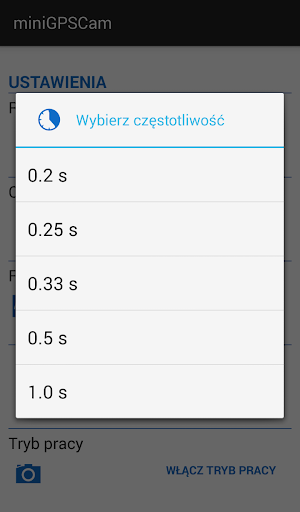
See the miniGPSCAM in Action
Get the App Today
Available for Android 8.0 and above